After Saturday night’s snow across the tri-state, get ready for a few more rounds of wintry precipitation coming up this week.
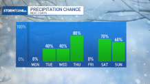
A series of storms will impact the East Coast through next Sunday, having a variety of impacts on the tri-state area.
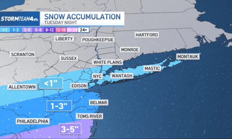
The first system passes south of the tri-state Tuesday night. South Jersey will be best positioned for a few inches of snow with this one. New York City may get just a glancing blow, with very little snow accumulation expected.

Washington, D.C. and the Delmarva Peninsula stand the best chance for big snow. Snow totals between 5 and 8 inches are possible in that area.
Small shifts in the track of this storm – especially if it tracks farther north — would bring big changes to the forecast for New York City, so check in with Storm Team 4 for updates as the storm gets closer.
Behind the Tuesday’s storm, we’re looking ahead to a chance for wintry mix Wednesday night, Thursday morning, and again next weekend. Timing and detailed impacts are still fuzzy, but temperatures are trending cold this week, so there will be more wintry weather on the way.
Rest assured that the coming week will be an unsettled one from a weather standpoint.